SERVICES
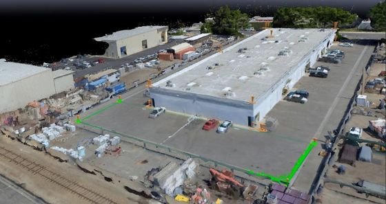
Our Aerial Imaging and Mapping services specialize in providing accurate 4K media and 2D and 3D maps, utilizing cutting-edge photogrammetry tools and radio-metric thermal imaging and infrared (IR) systems in HD, with 4K 60fps video feeds. All imaging is geo-tagged to the centimeter, providing the safest and most reliable imaging data and information to any architect or engineering professional, allowing for accurate measurements, including surface, distance, volume, and elevation, on high resolution maps, expediting the development process. Let us help you acquire the images, video, and data you need to operate efficiently and safely with our Imaging and Mapping services!
Whether its a new logo or magazine layout, our team has you covered. We have designed and created countless brochures and flyers for local events, assisted in creation and remodel of small business logos and brands. Our innovative and creative design department can take your ideas, and make them come to life. Be sure to check out the design services page to see some of our completed projects!
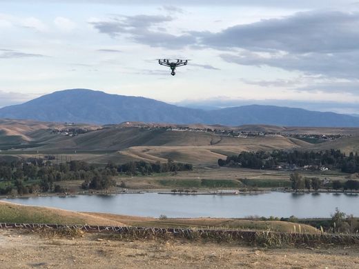
Quality drone service and repair is now available in North Bakersfield! Our team offers service and repair services for most personal and commercial drones, as well as custom builds and modifications. Our team has over 7 years experience building, flying, and repairing drones, with 2 members of our team holding Remote Pilot Certificates with the Federal Aviation Administration (FAA). Our team also offers education and training services to ensure proper rules and regulations are maintained while flying, and skills and techniques to ensure your drone makes a safe landing.
Our team has over 20 years experience teaching and developing Career Technical Education (CTE) courses in multiple industry sectors for grades 7-12, including the development of our Aerial Photography and Video course, which includes preparation materials for the Federal Aviation Administration (FAA) Remote Pilot Certification exam.
We offer course outlines and curriculum for classes in the following sectors:
- Arts, Media, & Entertainment
- Business and Finance
- Information and Communication Technologies
- Marketing, Sales, and Service
Our media production team is here to help you bring your ideas to the big screen! We have the ability to shoot and produce a variety of professional quality videos, including infomercials, interviews, marketing and advertising videos, and mini-movies. Whether your company wants to reveal a new product or you want to create a video memory of a a favorite trip, we have you covered!
Be sure to check out our different photos and videos on out social media pages!
Our resourceful and friendly team is here to help you fix your technology problem! Whether it be a slow internet connection, installation of an integrated home network, data removal and/or storage, virus identification and removal, small business network integration, our Tech department has you covered! Our team has over 20 years of experience servicing local small businesses and individuals with technology and computer services, working with individuals and small and medium businesses to develop secure and reliable networks at multiple locations to improve business operations and efficiency.


